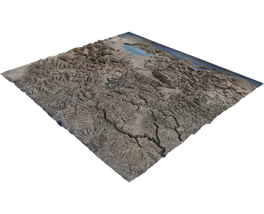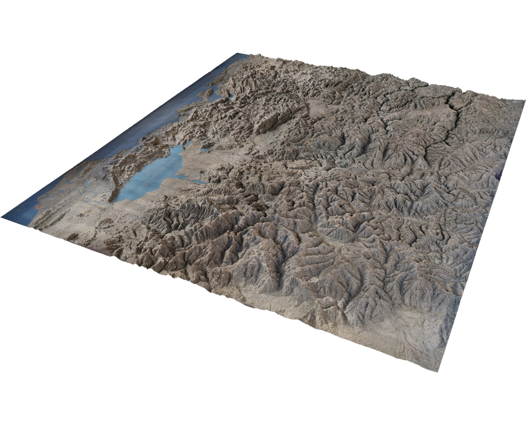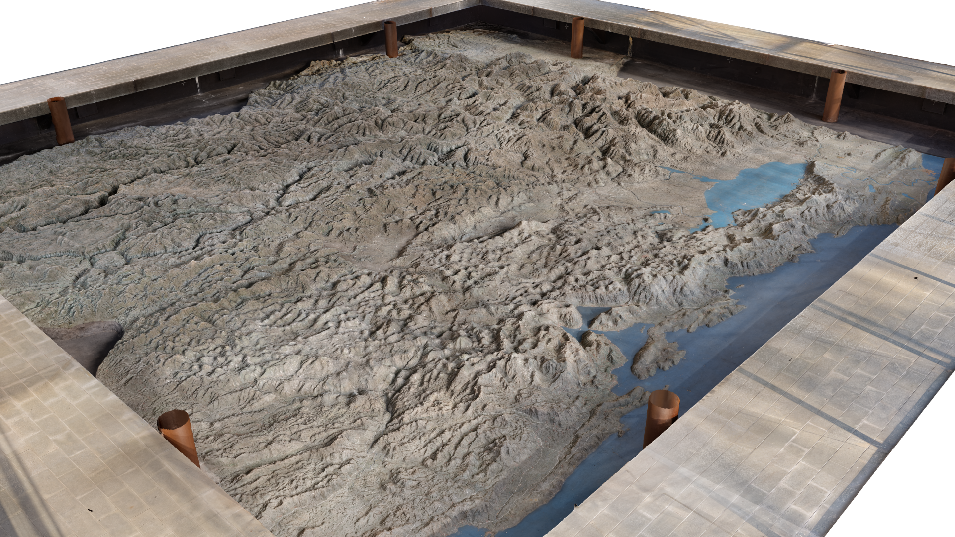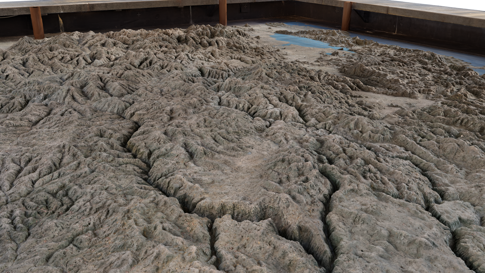
Relief Map of Montenegro
In the special pavilion of Biljarda is located the Relief Map of Montenegro erected in 1916 with the proportion 1: 10.000 after Austro-Hungarian Army realized the breakthrough of Lovćen front in Cetinje and held the southern part of Biljarda with the headquarter of occupation forces.The Relief Map of Montenegro, where parts of neighboring countries can also be seen, was made out of concrete on the stone base using the latest for that period of time an accurate Austrian topographic map.
According to the decision 1794/1 dated 14.09.1948, the Relief Map of Montenegro was recognized as a cultural heritage monument. Except the strategic military significance, this unique object acquires aesthetic and historical value.
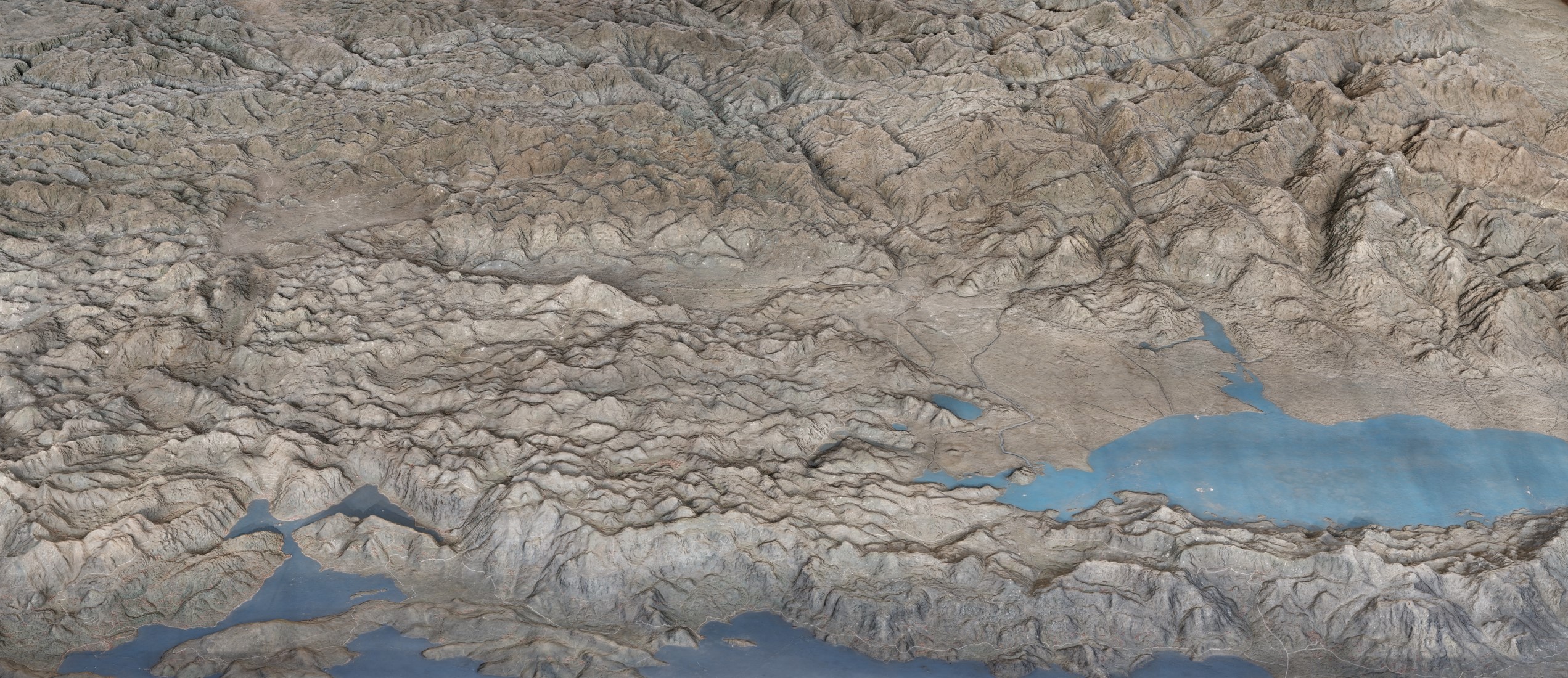
The Relief Map persuasive represents the terrain of Montenegro that ranges from high mountains along its borders on east, through a segment of the Karst region of the western Balkan Peninsula, to a narrow coastal plain that is only 2 to 6 km wide. The coastal plain disappears completely in the north, where Mount Lovćen and other peaks rise abruptly from the inlet of the Gulf of Kotor. The coastal region is noted for seismic activity.
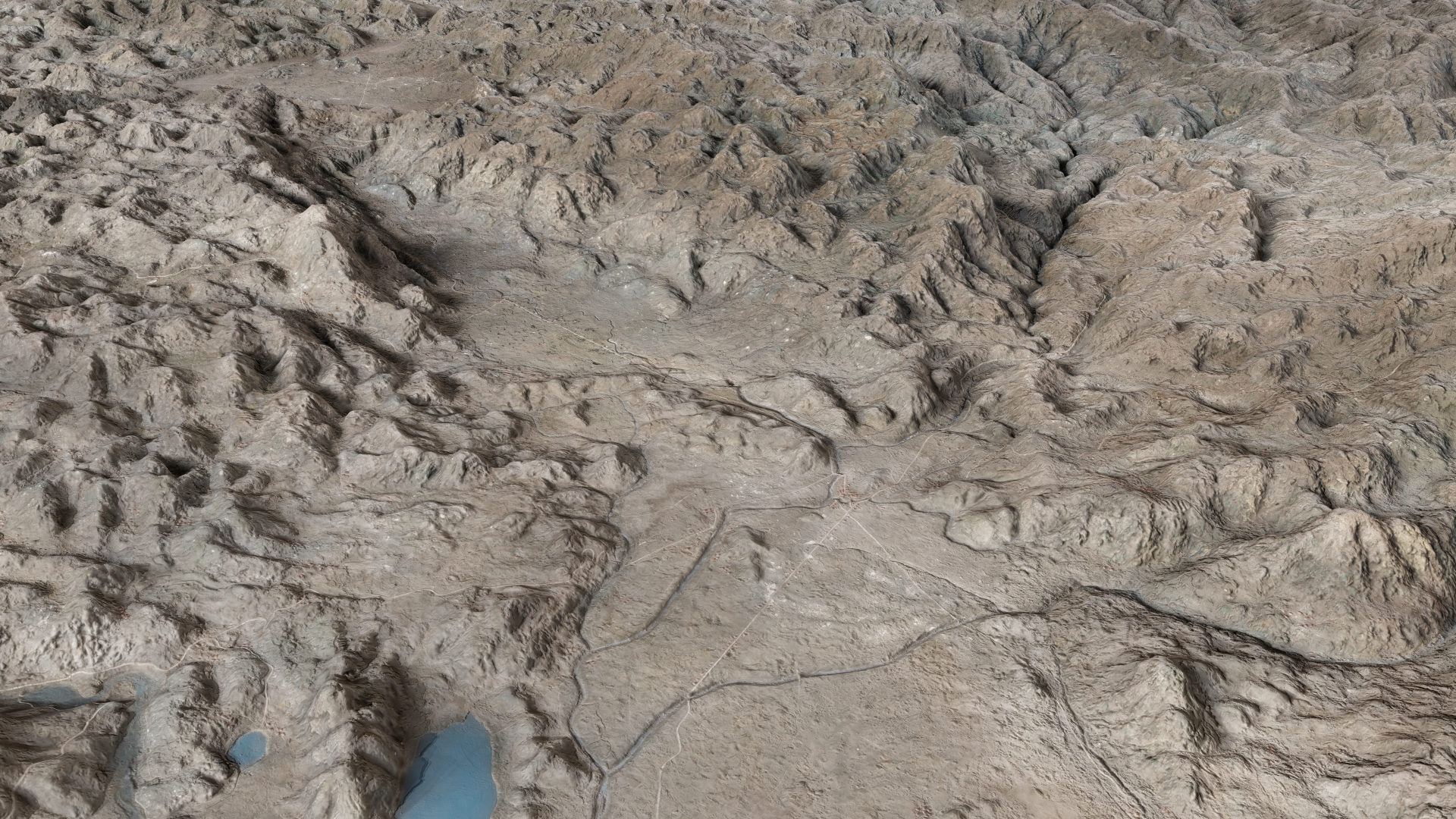
Montenegro’s section of the Karst lies generally at an elevation of 900 meters above sea level, although some areas rise to 1,800 meters. The lowest segment is in the valley of the Zeta River, which is at about 450 meters. The river occupies the center of Nikšić Polje, a flat-floored, elongated depression typical of karstic regions, as is the predominantly limestone underlying rock, which dissolves to form sinkholes and underground caves.
The high mountains of Montenegro include some of the most rugged terrain in Europe and average more than 2,000 meters in elevation. Notable is Bobotov Peak in the Durmitor Mountains, which reaches 2,522 meters and is the country’s highest point. The Montenegrin mountains were the most ice-eroded section of the Balkan Peninsula during the last glacial period.
The Tara River cuts the Tara River Canyon, the longest canyon in Montenegro and Europe and second longest in the world after Grand Canyon, at 78 kilometers in length and 1,300 meters at its deepest.